


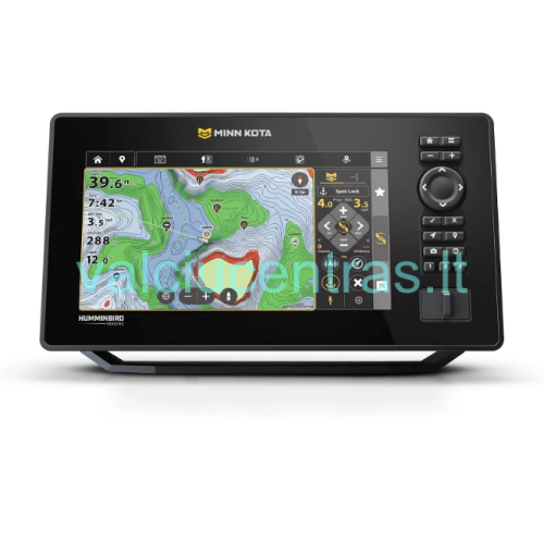
Minn Kota X9 fish finder
Local shops:
KAUNAS, Šlavanto g. 1
UTENA, Šaltinių g. 1
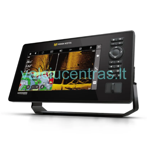
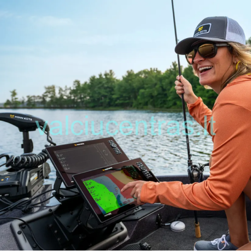
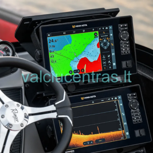
The Minn Kota X9 is a 9-inch fish finder developed in collaboration with Humminbird and equipped with advanced sonar, navigation, and boat control features. This device combines high-quality imaging technology, GPS navigation, and the ability to integrate the fishfinder with compatible Minn Kota electric motors and other “One-Boat Network” equipment.
The X9 uses the “Cross Touch” control system, which combines a responsive touchscreen with physical buttons. This allows for convenient operation of the device both by touching the screen and using the buttons, especially when your hands are wet. The 9-inch color TFT screen has a resolution of 1280 × 720 pixels, providing a clear and detailed sonar and navigation display. This model comes equipped with a standard sonar transducer that supports “Dual Spectrum CHIRP,” “MEGA Down Imaging+,” and “MEGA Side Imaging+” technologies.
KEY FEATURES
- “Humminbird Imaging” technology—high-quality sonar and underwater imaging technologies allow you to clearly see fish, bottom structure, underwater obstacles, and other objects.
- “Dual Spectrum CHIRP” sonar – traditional 2D sonar helps you accurately monitor water depth, detect fish, and analyze the underwater environment. “Full,” “Narrow,” and “Wide” operating modes are available.
- “MEGA Side Imaging+”—allows you to view the underwater environment to the left and right of the boat, enabling you to survey a larger area of water more effectively and detect fish, bottom structures, and underwater objects.
- “MEGA Down Imaging+” – provides a detailed view directly beneath the boat, making it easier to assess bottom structure, vegetation, and other underwater objects.
- “Cross Touch” control—the touchscreen, combined with physical buttons, lets you choose the most convenient way to operate the device.
- Integrated GPS receiver—allows you to determine the boat’s location, mark fishing spots, create routes, and track your path.
- “Minn Kota Maps” cartography—supports navigation maps that make it easier to plan routes and analyze the topography of the body of water. The device comes with “Minn Kota Maps,” and “Minn Kota Maps Premium” maps are available as an add-on.
- “AutoChart Live”—allows you to create real-time maps of the body of water’s bottom, recording changes in depth and the structure of the underwater terrain.
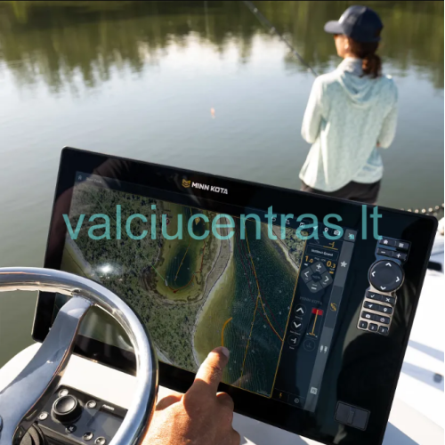
- “Draw & Navigate”—when used with a compatible Minn Kota electric GPS motor, you can draw your desired route on the fishfinder screen with your finger, and the motor will automatically steer the boat along that route.
- “Intelligent Depth Control”—when the fishfinder is paired with a compatible Minn Kota electric motor, the system monitors changes in depth, alerts you to shallow areas, and, with the necessary equipment, can automatically activate “Spot-Lock” and shallow-water anchors.
- “One-Boat Network” integration – compatible Minn Kota motors, Humminbird devices, and other network equipment can operate as a single system, providing more control and navigation options.
- Wireless connectivity – Wireless pairing of compatible devices allows for more convenient integration of the fishfinder with Minn Kota electric motors and shallow-water anchors.
- Network Connections – Supports Ethernet and NMEA 2000 connections, allowing the fishfinder to be integrated into a broader boat electronics system.
- Software Updates – The device’s software can be updated, allowing you to take advantage of improvements and new features provided by the manufacturer.
- Sonar recording and screen captures—you can record sonar data and save the information displayed on the screen for later analysis.
ADVANCED SONAR TECHNOLOGIES
The Minn Kota X9 is equipped with three key sonar technologies: Dual Spectrum CHIRP, MEGA Side Imaging+, and MEGA Down Imaging+. The combination of these technologies allows for a detailed analysis of the underwater environment and enables you to select the most appropriate imaging mode based on fishing conditions.
“Dual Spectrum CHIRP” is used to monitor fish, depth, and bottom structure. “MEGA Side Imaging+” provides a view to both sides of the boat, while “MEGA Down Imaging+” allows for a detailed view of what lies directly beneath the boat. This combination of technologies helps you find promising fishing spots faster and better understand the underwater terrain.
The included “XM 14 HW CMSI T” transducer is designed for mounting on the boat’s transom. It supports all three standard sonar technologies for this model and allows you to take full advantage of the fishfinder’s imaging capabilities.
INTEGRATION WITH MINN KOTA ELECTRIC MOTORS
The “X9” is designed to work in conjunction with compatible Minn Kota electric motors. Using the “One-Boat Network” system, information from the fishfinder can be linked to the motor’s navigation and positioning functions.
One such feature is “Draw & Navigate,” which allows you to draw your desired path on the fishfinder screen and send it to a compatible electric motor. This makes it possible to reach fishing spots more accurately and repeat planned routes.
The “Intelligent Depth Control” feature helps monitor changes in water depth and avoid shallow areas. When used with compatible accessories, the system can automatically perform boat positioning and shallow-water anchor control.
Additional advanced sonar solutions are also supported, such as “Minn Kota Live Sonar,” “Humminbird MEGA Live 2,” and “Humminbird 360 Imaging.” These devices are sold separately, and their compatibility depends on the selected model and connection configuration.
IMPORTANT COMPATIBILITY NOTE
- The X9 features a built-in GPS receiver and supports Side Imaging, Down Imaging, and 2D sonar technologies.
- The included “XM 14 HW CMSI T” transducer supports “Dual Spectrum CHIRP,” “MEGA Down Imaging+,” and “MEGA Side Imaging+” technologies.
- “Minn Kota Live Sonar,” “MEGA Live 2,” and “360 Imaging” equipment are sold separately.
- The “Draw & Navigate” and “Intelligent Depth Control” features require a compatible Minn Kota electric GPS motor, appropriate software, and a properly configured system. The “Draw & Navigate” route is plotted on the sonar screen.
- Ethernet and NMEA 2000 network functions may require additional cables, connectors, or other compatible devices.
- When installing the fishfinder in the boat’s dashboard (In-Dash), an additional external GPS antenna is required, which must be purchased separately.
TECHNICAL SPECIFICATIONS
| General Information | |
| Series | Minn Kota X Series |
| Model | X9 CMSI+ |
| Screen Size | 9" (22.86 cm) |
| Screen Resolution | 1280 × 720 pixels |
| Screen type | Color TFT, 24-bit |
| Controls | Cross Touch – touchscreen and physical buttons |
| Standard mount | Gimbal |
| Dimensions with standard mount | 12.066" × 6.708" × 4.097" (30.65 × 17.04 × 10.41 cm) |
| Dimensions with optional recessed mount | 11.69" × 6.258" × 3.495" (29.69 × 15.89 × 8.88 cm) |
| Optional Mounting | Gimbal mount |
| Software update | Yes |
| Warranty | 2 years |
| Sonar and sensor | |
| Included sensor | XM 14 HW CMSI T |
| Sensor mounting location | Boat transom |
| Standard sonar technologies | Dual Spectrum CHIRP, MEGA Down Imaging+, MEGA Side Imaging+ |
| Sonar Coverage Angles | 20°, 42°, 60°, and 2 × 86° (–10 dB) |
| CHIRP Frequencies | Full: 150–220 kHz; Narrow: 180–240 kHz; Wide: 140–200 kHz |
| Supported sonar frequencies | 50 / 83 / 200 / 455 / 800 kHz, HW DSC CHIRP, and MEGA |
| CHIRP / Imaging frequencies | 455 kHz DI+ (420–520 kHz), 455 kHz SI+ (405–505 kHz), Compact MEGA DI+ (1125–1225 kHz), Compact MEGA SI+ (1100–1200 kHz) |
| 2D sonar depth | Up to 600 ft (approx. 183 m) with standard transducer |
| Optional sonar depth | Up to 3,500 ft (approx. 1,067 m) with optional Airmar CHIRP transducer |
| Down Imaging operating range | Up to 200 ft (approx. 61 m) in MEGA mode; up to 400 ft (approx. 122 m) in 455 kHz mode |
| Side Imaging operating range | Up to 400 ft (approx. 122 m) in MEGA mode; up to 800 ft (approx. 244 m) in 455 kHz mode |
| Target resolution | 2.5" (6.35 cm) |
| Sonar recording | Yes |
| Screen shots | Yes |
| GPS and navigation | |
| GPS receiver | Built-in |
| GPS mapping | Yes |
| GPS track recording | Yes |
| Routes | 50 |
| Waypoints | 10,000 |
| Waypoints | 50 / 20,000 |
| Speed | Yes |
| Temperature sensor | Built-in |
| Temperature alert | Yes |
| Temperature graph | No |
| Connections and Compatibility | |
| NMEA 2000 | Yes |
| Ethernet | Compatible |
| One-Boat Network | Yes |
| MEGA Live / MEGA Live 2 | Compatible |
| Minn Kota Integrated MEGA DI / MEGA SI | Compatible |
| Minn Kota Talon / Raptor | Compatible |
| Minn Kota US2 Sonar | Compatible |
| Minn Kota i-Pilot Link | Compatible |
| Radar | Compatible |
| AIS | Optional compatibility |
| Autopilot | Compatible |
| Heading Sensor GPS Compatibility | No |
| Power and Additional Features | |
| Power Supply Voltage | 10.8–20 V DC |
| Power Consumption | 2.2 A |
| Sonar Transmitter Power (RMS) | 1,000 W |
| Sonar Transmitter Power (Peak-to-Peak) | 8,000 W |
| Micro SD card slots | 2 |
| Customizable displays | Yes |
| Customizable images | Yes |
| X-Press menu | Yes |
| Quick Scene Selection Buttons | Yes |


 SOLD OUT


